The Role of Borehole Logging in Sustainable Groundwater Management
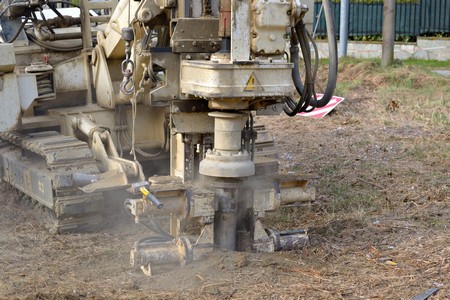
Borehole logging is a critical technique in the field of hydrogeology, providing essential data for the sustainable management of groundwater resources. By offering detailed insights into the subsurface conditions, borehole logging enables scientists and engineers to monitor aquifer health, detect contamination, and manage water resources effectively. This blog explores how borehole logging contributes to sustainable groundwater management practices, the techniques used for monitoring and detecting issues, and its significance in environmental impact assessments and regulatory compliance.
Contribution to Sustainable Groundwater Management
Sustainable groundwater management aims to ensure that groundwater resources are utilized efficiently without compromising the needs of future generations. Borehole logging plays a vital role in this process by providing accurate and comprehensive data about the geological and hydrological properties of aquifers. This information is crucial for developing sustainable extraction plans, preventing over-exploitation, and maintaining the natural balance of groundwater systems. Through borehole logging, hydrogeologists can obtain continuous records of subsurface conditions, including lithology, porosity, permeability, and fluid content. These logs help in identifying productive aquifers, assessing recharge rates, and determining the sustainable yield of wells. By understanding these parameters, water managers can make informed decisions on well placement, pumping rates, and groundwater conservation strategies.
Techniques for Monitoring Aquifer Health
Borehole logging encompasses various techniques that are instrumental in monitoring the health of aquifers. Some of the most commonly used methods include: 1. Gamma-Ray Logging: This technique measures the natural gamma radiation emitted by rocks and sediments, helping to identify different lithological layers and their characteristics. 2. Resistivity Logging: By measuring the electrical resistivity of the subsurface materials, this method can detect variations in lithology and fluid content, indicating the presence of water-bearing formations and potential contamination zones. 3. Neutron Logging: Neutron logging measures the hydrogen content in the formation, which is directly related to water saturation. This technique is particularly useful for determining porosity and identifying water-filled zones. 4. Caliper Logging: This method measures the diameter of the borehole, helping to identify zones of borehole collapse or enlargement, which can indicate structural weaknesses or the presence of fractures. By employing these techniques, hydrogeologists can continuously monitor the condition of aquifers, detect changes in water quality, and identify early signs of contamination or overuse.
Detecting Contamination and Managing Water Resources
Detecting contamination is a critical aspect of sustainable groundwater management by our geophysical services. Borehole logging provides valuable data for identifying and mapping contamination plumes, tracking their movement, and assessing the extent of pollution. Techniques like resistivity and gamma-ray logging can highlight anomalous zones indicative of contaminants such as heavy metals, hydrocarbons, or saline intrusion. Effective management of water resources also relies on borehole logging to optimize extraction strategies and ensure equitable distribution. By understanding the spatial distribution of aquifers and their hydraulic properties, water managers can design well fields that minimize interference between wells, reduce drawdown, and prevent adverse impacts on nearby water bodies and ecosystems.
Importance in Environmental Impact Assessments and Regulatory Compliance
Borehole logging is essential in conducting environmental impact assessments (EIAs) for North Jersey projects involving groundwater extraction, infrastructure development, or waste disposal. Detailed subsurface data provided by logging techniques help in assessing potential impacts on groundwater resources, predicting changes in water quality, and designing mitigation measures. Regulatory agencies often require comprehensive borehole logging data to ensure compliance with groundwater protection standards. This data is used to establish baseline conditions, monitor ongoing activities, and verify that extraction practices adhere to legal and environmental guidelines. In summary, borehole logging is a fundamental tool in sustainable groundwater management, offering critical insights into aquifer health, contamination detection, and resource management. By enabling precise monitoring and data-driven decision-making, borehole logging helps ensure that groundwater resources are used responsibly and sustainably, protecting them for future generations while supporting current needs.